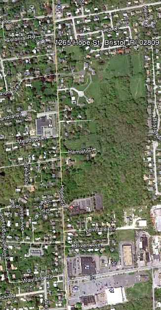
We’re going to use this class session to take a look at some neighborhoods with which we’re familiar: Our own. To do this we’ll use three very interesting Internet resources: Google Earth (which you’ll have to download and install on your computer–it’s free), the Google Maps with Streetfinder, and Bing Maps. The Google Maps and Bing don’t require any additional software. All these programs require a little playing with to understand their full capabilities, but you‘ll have fun learning them, I almost guarantee it..
1.In each (or at least two) Enter the Street Address of your home. If you’ve lived in several houses in several cities/neighborhoods, then enter the address of the one you most consider home.
2.Look at this address at several different levels of magnification so you can orient to the local neighborhood and to larger areas as well.
3.On the right or left (left side you’ll see the Smartview column. Each of the principal categories (food & dining; recreation & entertainment, community services, etc.) expands. Clicking on the various topics will locate these resources in the vicinity of the address you enter. Locate such things as schools, libraries. Where are they in relationship to “home?” Online, you’ll be able to run your cursor over the icons and find the names and addresses of these.
4.Print off a few of the maps or views which you create. On them, write in the names of the community services, etc. which are in your vicinity. How many of them do you recognize? How many of them have you used?
5.How many of the resources would be accessible to you on foot? How many by public transportation? Where is there public transportation? Google Earth will show you commuter lines. How many require a car?
We’ll discuss what these maps tell us about the relative richness in resources in our several neighborhoods.
Take a walk down Hope St. (Route 114) and see how far it is to the nearest school, medical center, and shopping center.
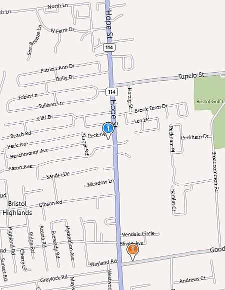
Below are two more views from Google Earth and Bing Maps. On Bing, where I can walk from my house to get a good spinach pie.
For Thursday, February 2The Golden Vision of City Life.
Read, in
Kenneth T. Jackson, Crabgrass Frontier,
Introduction: pp. 3-12
1.Suburbs as Slums, pp.12 - 19
2.The Transportation Revolution and the Erosion of the Walking City pp. 20 - 45
This book is about American havens. It suggests that the space around us–the physical organization of neighborhoods, roads, yards, houses, and apartments–set up living patterns which condion our behavior
Jackson, 3
On Monday we looked at the communities which we consider our own. We started to get a sense of the institutions which constitute them, and looked at the widely varying types of communities which are part of the American fabric. Today we’ll start to develop a theoretical framework for understanding those differences.
The Introduction will help us frame a definition of “Suburb”. We’ll find defining suburb is more difficult than it seems at first. We’ll encounter political definitions and socioeconomic definitions, and we’ll also see that American residential patterns are very different from those of the European countries from which the founders of most American places sprung.
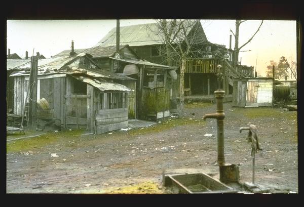
Chapter I will take us back to days when Suburbs were anything but desirable places to live. The name suggests this: sub-urban areas are beneath or inferior to urban ones, or at least were, from the days of Classical Rome to the early 19th century.
Chapter II will introduce two very important concepts, first, the walking city and second, the transportation revolution which radically transformed the nature of cities. Two thousand years of urban history were transformed in little more than a single generation. We still live with the promise (and problems) of that transformation
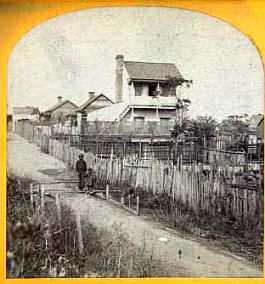
A Suburban slum outside of Philadelphia, in what would become the fasionable "main line" area. Click on the photo to browse other interesting historic photograhs in the Library of Congress Collection.